It has taken some time to actually come to terms with the outcome of my PCT hike dream and to make this post.
Unfortunately this was not my year to hike the PCT. The sad truth of the matter is that I hurt my knee pretty bad and will not be able to do a long distance hike. It's been a little over 3 weeks now and although the severe pain is no longer there the soreness and weakness persists.
It has been hard not being out in nature for the past few weeks. I was planning on using that time to do a little reflecting, soul searching and just a plane way of disconnecting from the "Matrix" living of society for a bit. I have even tried to talk myself into heading back out and disregard the physical issue at hand (which would not have been a "Smart" choice). I am now back at home, healing up and looking for a job.
With all that being said I just wanted to let the few folks who may have been wanting to follow along that this was just not in the cards to head on a long hike. I am hoping that my knee will be well enough to get back out on the weekends to do shorter trips with less pack weight in the future though. I do apologize to any who had their hopes up of following along :( I can assure you that I am extremely disappointed in the outcome myself.
Thank you all for your kind words, support and motivation leading up to what could have been an epic adventure. Don't count me out....just down for a bit :)
Saturday, May 7, 2016
Saturday, April 9, 2016
PCT (Pacific Crest Trail) Thru Hike 2016 - Clothing
Above you will find a short video of the clothing that I will be wearing at the start of my hike.
Hat : Outdoor Research Full Brimmed Hat (not sure on current pricing as I purchase this in 2010).
Sunglasses: Prepper - $39
Bandana: REI - $5
Shirt: Short sleeved (No price available - purchased in 2008)
Shirt: Columbia Silver Ridge Lite - $55
Pants: Columbia Silver Ridge Convertible Pants - $60
Gators: Dirty Girl Gaiters - $21
Socks: Darn Tough - $18 and Wrightsock Coolmesh II - $12
Shoes: LaSportiva Wildcats - $110
I was very fortunate to have accumulated enough dividend dollars at REI to completely fund my entire clothing assortment for this trip which greatly helps out considering the expense of quality gear (as you can see by the prices).
I have never done any desert hiking so this will be a trial by error endeavor and this list may or may not change as I progress up the trail.
I hope this provides some insight into what I will be starting off with. As I mentioned before (disclaimer) this is only what I believe (and hope) will work for me and should only be used as a guideline for making personal decisions which will work for you.
Until next time......
Rovious
Thursday, April 7, 2016
PCT (Pacific Crest Trail) Thru Hike 2016 - Planning
I have comprised a short video showing what material I have used in the preparation for my upcoming PCT Thru Hike Attempt starting this April.
I hope the information I found useful helps out in possibly planning your future adventure. This is by no means a complete list of all the material on the market, but rather some information that I found the most useful in "my" planning.
If you would also consider donating to the ASPCA through my memorial campaign for Lilly that would also be appreciated.
www.ASPCA.org/team/seth-s-memorial-campaign
As always.....
Happy Trails!!
Rovious
Sunday, March 13, 2016
PCT (Pacific Crest Trail) Thru Hike 2016 - Introduction
So it's that time to embark on another adventure. I originally had no real plans on doing another long distance hike for a long time, but the timing just seemed right at this point for a long walk.
I had transitioned back into a job from one of my previous career fields that I had hoped would progress into something other than an entry level position. Unfortunately the possibility of upward movement in the company seemed little to none in the foreseeable future so I decided to cut my losses and go back into the field in which I have worked the past 7 years.
Also, we are thinking about relocating out west after this year. We have come to a conclusion that we need a change of scenery and will be moving to Colorado to start a much bigger adventure as well as be able to participate in activities that we both enjoy more frequently (and without a 4-5 hour drive to start and end the weekend to get to).
Unfortunately this year started off on a very bad foot. We lost our baby girl (our golden) to cancer unexpectedly the first of the year. I can honestly say this is the hardest loss that I have ever experienced. Months later I still feel a huge hole in my life. I am dedicating this walk to her and in her memory. I have set up a memorial page in her honor:
www.ASPCA.org/team/seth-s-memorial-campaign
if anyone would like to donate! ALL funds go directly to the ASPCA!!!!
Look for additional videos and posts in the near future including : Preparation, gear, clothing and on trail adventures.
Until Later......
Rovious
Sunday, November 29, 2015
Sunday, June 7, 2015
Appalachian Trail - Laurel Creek to Pearisburg, VA
Over Memorial Day weekend I decided to get out and take a little trip in Virginia. Originally I had planned on attempting a thru hike of the Foothills Trail, but decided to take a trip that would allow me a better chance of success. Pushing out 77 mile on the FHT over a weekend would have set me up with monster mile days and a sense of necessity rather than enjoyment. I was extremely happy with my decision as the weather and terrain were perfect for hiking in the "Longest State" on the Appalachian Trail.
I drove to Pearisburg, VA after work on Thursday night so I could get a early morning shuttle on Friday. I slept in my van in the church parking lot next to the Holy Family Hostel. I had stayed there once before on a previous hike, but rather than waste needed time for rest and sleep setting up and tearing down camp the van just seemed like the better option.
I was meet at the parking lot bright and early (6am) by my shuttle driver. Don Raines is based out of Pearisburg and is extremely reliable and knowledgeable about the trail in the area. I had used him before on the previously mentioned trip and knew he would be a great choice. (You can find his information in Awol's Guide) The drive to my drop off point was picturesque and filled with promise of great weather.
Arriving at the trail head just after 7am I was ready to put in some miles. The weather was perfect for hiking!!! Mid 50's and breezy!! The grade of the trail in this area is very gradual and made for a good start to what was going to be a longer day on the trail.
Not too long into the morning I was greeted by two fellas who recognized me from my Youtube videos. We had a short, but great conversation and they really set the positive tone for my day. It really makes me feel good to know that the videos I put out there help motivate or inspire others to Get Out and Hike. Little did they know they truly inspired me for the rest of my hike. To see people out enjoying themselves, accomplishing personal goals, staying healthy really is such a positive thing to see. I couldn't help but reflect on that meeting the rest of my journey and just feel good about it.
The weather was perfect and I meandered through the hills lost in thought the remainder of the day. Leapfrogging with 2015 Thru Hikers throughout the day really had me thinking of my attempt in 2012. Reflecting on memories of the past made the day go by relatively quickly and before I knew it I made 19 miles to Jenny Knob Shelter where I would decide to call it a day. I was the only one at the shelter (setup outside in my tent as usual) until around 10pm when I heard a weary hiker trudge in and settle in the shelter for the night.
I woke up with the birds as my alarm clock and hit the trail shortly after 6am on Saturday morning. The weather was once again perfect for hiking and I made great time. The only issue with starting off early in the morning before everyone else is that I get to clear the trail of spider webs for all the late risers. The nickname for people on the trail who do this has been dubbed "The Web Master" and this morning I truly was this.
Shortly after starting my hike I arrived at my first road crossing of the day. I was greeted by a past thru hiker out providing Trail Magic. I stopped to say hello and thank him for his efforts, but decided not to take anything so he could save it for the deserving thru hikes that would shortly be coming through.
For the most part the trail was relatively smooth and flat during the morning. It meandered next to a stream and through a peaceful wooded setting up until I stopped for lunch. Knowing the day would be a high mileage day the easy terrain was very welcome. I made great time and had put in around 14 miles by the time I stopped for lunch.
Stopping to eat right before a gruesome climb was a good decision. Not only did I get a chance to camel up, fill up my water bottles, rest and air out my feet, but I was also able to consume the needed calories I would need for energy to boost me up the mountain. After my usual 45 minute break I pushed on.
After the climb to the top of the hill the remainder of the day wasn't too bad. Originally I contemplated stopping at Wood's Hole Hostel to experience what it had to offer, but as I heard from the thru hikers who I had encountered the place was going to be packed. I decided to stick to my original plan and press on to Doc's Knob Shelter where I would call it a day.
There weren't really any sites at the shelter for tenting and I am not a huge fan of sleeping in shelters. I decided to backtrack the tenth of a mile to an old road bed and setup my tent alone for the evening. Once in my tent I checked to see if I had cell service and was able to get a few texts and a call out to home. Upon doing so I received the bad news that one of my dogs had fallen ill and had to be rushed to the emergency vet. This didn't make my evening a very relaxing one. There was nothing I could do from where I was at and this made me feel quite useless and depressed. There was no way I could make it the 10 extra miles to the car before dark even if I had wanted to and even if I did she was already at the vets.
I awoke before the sun came out and was on the trail in the morning just as enough light was available to see the trail. The morning was another spectacular one which made the stress of getting back to home to see my pupp a little more tolerable. I made it back to the vehicle shortly after 10am and headed home (as I sit here typing this it has been a while since this journey and she is doing well again!!! :) ).
Another great adventure (minus the stressful part at the end) !!!!! Virginia usually gets a bad wrap for being a big green tunnel. It can be a little daunting from a thru hikers perspective if one is counting down the states, but otherwise it is a great place to hike and I encourage everyone to give it a shot.....you will not be disappointed!!!
Until the next adventure......
Happy Trails!!!
~ Rovious
Sunday, May 17, 2015
Appalachian Trail - Tray Mountain Road (GA) to Deep Gap (NC)
Trip:
Tray Mountain Road to Plumborchard Shelter (16.8 miles) - Day 1
Plumborchard Shelter to Deep Gap (NC) (11.3 miles) - Day 2
Shuttle Service:
Joyce and Sally - (706)896-9339
Picked us up at Deep Gap and drove us to Tray Mountain Road
Very Nice people and great conversation during the trip :)
Difficulty:
Strenuous - Lots of ups and down with many climbs very steep.
Dates:
April 25th-26th, 2015
Sunday, May 10, 2015
Appalachian Trail - Glassmine Gap to Deep Gap
Trip:
Long Branch Trail - 2 Miles
Appalachian Trail (Glassmine Gap to Deep Gap) - 17.9 Miles
Kimsey Creek Trail - 3.7 Miles
Trail Head is located 200 yards past the entrance of the Standing Indian Campground with ample parking.
Sunday, April 5, 2015
Food Labs - Poor Man's Pantry - Beef Stroganoff
Recipe:
1 Knorr Sides Stroganoff
1/4 Cup Dehydrated Beef Gravel
1/8 Cup Dehydrated Peas
1/8 Cup Dehydrated Mushrooms
1 Tablespoon Beef Gravy
Combine all ingredients in a Quart Freezer Bag. Add 2.5 Cups boiling water to bag and insert into pot cozy. Let stand for 15-20 minutes. Enjoy!!!!
I decided to start making more homemade meals for my backpacking trips as the price of the commercial meals have gotten quite expensive.
Since the Mountain House Beef Stroganoff has always been my go to meal for hiking I decided to start with it. I have come up with an alternative that costs less than $3 compared to the $8 + tax that the Mountain House counterpart comes in at.
I really enjoyed this concoction and will definitely be making it again. I would give it an 8-9 out of 10 (if compared to a 10/10 for the Mountain House).
If you have any suggestions or recipe tips please add them in the comments so myself and others can benefit from them.
Until next time......
Happy Trails!!!!!
Sunday, March 22, 2015
Appalachian Trail - Tray Mountain Road to Neel's Gap - 24.6 miles
The other weekend a friend of mine and I took a short trip on the Appalachian Trail in Georgia. I helped my buddy with gear selection for his inaugural hiking experience. He did extremely well and thoroughly enjoyed the experience.
I have published the accompanying video that details the trip.
Happy Trails!!!!
Rovious
Wednesday, March 18, 2015
Packit Gourmet - Dotties Chicken and Dumplings Review
I recently purchased a meal to try from Packit Gourmet - Dotties Chicken and Dumplings. I really didn't know what to expect as this is a relatively new company to me. I can definitely say that I was not disappointed.
The meal comes in a very well thought out package that allows you to cook the meal right in the bag. You will more than likely need to construct a pot cozie (or purchase one from their website) to keep the meal piping hot while it rehydrates.
The ingredients are all high caliber from what I experienced. The chicken base which comes in a viscous form is very flavorful and much better than what I have experienced with boulon based flavorings. What really caught my attention was the little pieces of what I perceived to be real chicken. As I expected the vegetables take a little bit longer to rehydrate, but the longer the meal sat in the water the more tender they became.
The only thing that I would have changed would have been to add slightly less water than what the packaging recommends. This is not to say that the quality is degraded from what is called for, but based on MY personal thoughts of what dumpling texture should be I would have prefered it to be slightly thicker and more concentrated (but that is solely my opionion and would recommend experimenting to meet you own personal preferences).
I would highly recommend trying this meal if the flavor profile sounds like something you would enjoy. The quality of the product is exellent!! I will definitely be trying more products from this company!
Until next time.....
Happy Trails!!
-Rovious
Friday, November 7, 2014
Appalachian Trail - Newport, VA (VA42) to Pearisburg, VA (US460) - Trip Report
This past weekend I decided to take a trip down the AT as the fall colors were at their peak. It seemed like the perfect opportunity to get away for a weekend, doing something I truly enjoy, allowing me to clear my mind and get away from it all.
I left Thursday afternoon from work with the intent of arriving before dark at a Hostel I had found in AWOL's AT Guide in Pearisburg, VA. Although the hostel was not close to the trail I didn't mind as I had arranged a shuttle to meet me there, direct me to a parking area (where I would hike back to at the conclusion of my trek), and take me to the trail head in Newport where I would start my adventure. From what the shuttle driver had told me during our phone conversations while arranging the shuttle the hostel would be closed, but I would be able to camp outside without any issue.
When I did arrive at the Holy Family Hostel I was greeted by the owner's daughter and boyfriend (strange situation as I was getting changed in the back of my van in the parking lot). The informed me that the hostel was unlocked and I was welcome to stay inside if I wanted. I did venture in to the hostel and explored what it had to offer. As I did so Gypsy (the boyfriend) came out to speak with me for a bit. We spoke about how he ended up at the hostel on a work for stay and how his section hike from PA southbound had come to an unexpected end when he meet his new girlfriend. We shared stories of our hiking adventures and what it was like to be so attached to the AT. Before he left me for the night he informed me of numerous LARGE blacksnakes that had made the hostel their home. He even pointed out some snake skins that were in the cracks of the walls. He left shortly after and I decided to look through the hostel registry which confirmed such sightings. I quickly decided that my original plan of camping on the lawn next to the cemetary was the better option.
After a good nights rest (not sleep) I awoke early to pack things up and get ready for my driver to arrive. I tore down my tent, loaded my pack and used the hostel to do my morning chores before making my way to the parking area to wait for my shuttle driver.
Don arrived right on time as scheduled and I followed him to the parking area where I would drop off my car. Once there I switched my gear to his vehicle and we were off. He gave me the low down on trail conditions that were definitely beneficial such as water sources (more importantly where they were lacking) and a reroute that had been made since I came through a few years back. He was a real nice guy who is more than willing to help out hikers in need "any time and any place" as he mentioned several times.
We arrived at the trail head in Newport on VA42 just before 8:00 am. I was greeted by a friendly donkey who came rushing to the fence as we pulled off the side of the road. I picked a few of the burrs off its face, patted it on the head and let it lick my hand while Don and I spoke of his encounters with the lovely critter when he dropped other hikers off here. Don wished me luck and we were both on our separate ways - me on a 40 mile trek southbound and he off to a good and hearty breakfast.
After performing the final arrangements to my gear in the dewy high grass of meadow I headed down the trail. The sun was just coming up over the ridge and the sky was filled with hues of pink, orange and blues. I knew right off that this was going to be a great weekend!
The first couple miles of hiking were a gradual uphill. I passed through meadows and farmland before making my way into the woods. I occasionally stopped to take in the scenery, remove layers as I heated up and to just take in what nature had to offer. It had been too long since my last outing and I just got lost my surroundings. The final push to the top was a little steep, but I was rewarded by some amazing views at Kelly Knob.
So many times when I am out hiking I tend to pass the little side trails that lead to picture spots or scenic overlooks. When I am out and about with others we seem to try and get to where we are going and hike at different speeds to get there. Today being alone I was free to hike at my own pace and had no real plan as to where I would stay for the evening. This afforded me the opportunity to stop and take as much time as I wanted for breaks. I decided to take the side trail to Kelly Knob and rest for a bit which I was so glad that I did.
The overlook is an outcropping of rock with deep fissures plunging into the hillside below. I had to jump across a few of them to get to my resting spot, but the views were more than worth the risk. I sat there for about 30 minutes eating a pouch of tuna and a small snack back of chocolate trail mix enjoying the panoramic view. The colors were in full transition with some of the trees already shedding their leaves. It was so quiet with the absence of human activity obvious and welcomed. I finally had to pull myself away as I did need to put at least a few miles on the odometer for the day.
The descent down into the valley was not too strenuous allowing more of an opportunity to keep my eyes on my surrounding and not down on the ground watching for roots, rocks and ruts. At the bottom of the hill was a well flowing stream where I decided to camel up on water and fill up my water bladder for the next 2000' climb that I was about to tackle.
I had opted to take my Sawyer Squeeze on this trip rather than the Sawyer Mini or any of the other pump filters that I have accumulated over the years. I found an adapter trick online that uses a "Tornado Tube" (a child's experiment/toy that is used between two 2 liter bottles to create a simulated tornado) which can be attached between the filter and Platy bags or bottles. I did have to cut about 1/4" off of one end so it would tightly fit onto the filter before leaving, but I am glad I decided to try this out. The flow rate was by far superior to the Sawyer Mini (with the adapter I had created out of an old hydration bite valve tube) and a lot easier to use. It does weigh about an ounce more, but I found it to be worth it for my particular situation.
Fully hydrated and packed up I started my ascent to the top of the next ridge. The climb wasn't all that bad, but did meander all over the hillside and valley making me think that some drunk trail engineer just couldn't make up their mind as to where to put it. This is where I finally ran into my first set of hikers. A couple of old gents in their 70's with packs that were as old school as they were (external frames packs - which I still have one myself, with all sorts of things strapped to the outside). Just goes to show that one doesn't need all the latest and greatest gear to get out and enjoy the simple things in life. We stood and chatted for a bit on the side of the hill before they continued down the mountain and I continued trudging up hill.
When I finally made it to the top I was more than ready to take a nice long lunch break. As I reached the apex I immediately saw the perfect rock to plop down upon and rest my tired body. Just as I was about to I noticed two oddly placed game cameras on both sides of the trail strapped to the base of trees. For a split second I contemplated moving on and finding another spot to enjoy lunch, but that was only for a second. I decided that whoever had set these up would just have to suffer wading through a few pictures of my enjoying my well earned lunch. I sat down, took out my cook kit to boil some water for my Ramen Noodles, removed my shoes and socks and enjoyed a nice package of beef jerky. It felt so good to sit for a bit and get some calories in my belly. I rested for about 45 minutes before deciding it was time to pack up and head down the trail.
Looking at my map and elevation profile it did not look like the trail would be too difficult as I made my way to Bailey Gap Shelter. I couldn't have been more wrong. The last time I headed through this section of trail I was heading North bound and was on a mission to catch up with my hiking partner who had gotten about a day ahead of me (2012 Thru Hike attempt). That was a 35 mile day and I was in such a zone that I really wasn't paying much attention to the trail at that point. Today was much different as I was not in as good of shape as then and not going nearly as far or fast.
The three miles before the shelter were nothing but rocks covered by a layer of leaves. I couldn't begin to count the numbers of times that I tripped or rolled my ankles while traversing this section of trail. I had let out countless obscenities during and hoped that the soft dirt would return soon. Reading over the ledger at the shelter when I arrived confirmed that I was not the only one who felt this way. The entries from Southbound Thru Hikers who had come by only a day earlier had left comments cursing the rocks in that section as well.
I did arrive at the shelter just before 6pm and decided that this would be the place I stopped for the evening. I sat alone for a while just enjoying the quiet, read the shelter ledger for a while and finally just enjoyed the sun setting over the distant ridge painting the sky with beautiful colors before allowing natures lights to go out in preparation for a starry sky. I climbed into my tent and settled in for a nice long rest.
Unfortunately a deep sleep eluded me over the course of the night. I got plenty of rest and felt extremely relaxed with the sounds of nature surrounding me, but could not get completely comfortable with the pain in my left foot constantly reminding me of the miles of rocks before camp.
I decided to get a good start on the day and crawled out of the warmth and comfort of my sleeping bag before the sun showed its presence. Being a little chilly in the morning usually makes me move a little faster from the point where I unzip my bag to then conclusion of breaking down my tent. It was still dark by the time I was starting my breakfast so I just took my time and waited until it was light enough to start down the trail without killing myself on hidden obstacles.
At 7:30 it was time to get moving. The first few miles were downhill and the soreness in my left foot was pretty noxious. Fortunately the rocks had diminished to normal trail conditions and with a steady supply of Vitamin I the pain became tolerable.
I made it to the bottom of the mountain just as the sun was making it's way over the ridge. The Captain's Place in just off the trail in this area and would make a good resting point for a weary thru hiker, but I had miles to get under my belt and could only stop to take a quick picture and video.
I had stopped at the Pine Swamp Shelter for a quick snack and to fill up my water bags before heading up my one big climb of the day. There is a stretch (heading SOBO) of approximately 11 miles where there isn't any water listed. One could probably hold off for a mile or so past the shelter as a stream follows the trail, but I wasn't taking any chances. I drank 1 liter straight away and filled my Platypus with 2 liters just to make sure. Fueled and hydrated I made my way up the winding path to the top of the ridge.
Once at the top it was pretty much putting it in gear and cruising. The trail was pretty flat (as flat as a mountain could be) and made for a comfortable 2.5 mph pace.
I rested for a bit around noon and ate my lunch on a large fallen tree trunk. As I was packing up two hikers heading my direction strolled upon me. We exchanged hello's and were on our way. The first people I had seen in 24 hours, but I quickly left them behind when they decided to stop for lunch themselves.
Just after passing Symm's Gap the scenery became very appealing. I passed through meadows and pastureland which offered spectacular views of the valley below. With the fall colors painting the mountain sides I couldn't help but to continuously stop and just soak in the views.
I arrived at the Rice Field Shelter a little earlier than expected (3pm). It is a perfect spot to stop with views on both sides of the mountain and plenty of spots to pitch a tent. After mulling it over for a short while I decided to press on the final 6ish miles rather than stay especially since it was still so early in the day, I had not seen anyone else out hiking and the remainder of my hike was all downhill.
The final descent into Pearisburg is a newly opened reroute. I was having a hard time remembering what the trail was coming NOBO when I came through in 2012 as I was trying to put in some big mile days to catch up to the group I had been hiking with, but the grade was definitely a lot more gradual and very wide. The miles seemed to melt by and since the terrain wasn't difficult to navigate I was able to keep my eyes on the surrounding rather than on the ground. I saturated my soul with the fast changing fall colors and smell of fall in the air. I knew it had been too long since I had been out last and this just reaffirmed my need to get out more often.
I made it to my car a little before 6pm and was on my way. A burger was calling my name and it wasn't long before my belly was full and the calories I had burned on this 22+ mile day were replenished.
NOW......onto the next adventure!!!!!!
Happy Trails!!!!
Saturday, June 28, 2014
Appalachian Trail - Hampton, TN to Damascus, VA - Video
Here's the video from my recent adventure....Unfortunately the weather didn't cooperate on the second day so I apologize in advance for the lack of scenery.
Until next time........
Happy Trails!!!!
Rovious
Monday, June 23, 2014
Appalachian Trail - Hampton, TN to Damascus, VA - Day 2 (26.7 miles)

I woke up early this morning to fortunately a lot drier weather than I fell asleep to. I use the birds as an alarm clock as they usually start chirping about 15 minutes or so before the day breaks. Although it was much dryer when I woke up the rains and fog where ever present for most of the day.
I started hiking around 7am and was almost immediately greeted by a feeding deer on the side of the trail. It didn't seem to mind my company much and after checking me out for a minute it continued its grazing. I enjoyed watching it for a few moments and then was on my way.
The day was not very eventful and I spent all morning hiking in a rain cloud where only 20 or so yards in front of me were visible. I was hoping to get some good pictures and videos (especially of the field near the handicap accessible portion of trail), but had to keep the cameras inside my pack to keep from being ruined.
By mile 13 I was feeling pretty tired and had serious doubts that I would make it to my goal of a campsite that was located 4 miles North of Abingdon Shelter. When I finally did arrive at the shelter I immediately took the .2 mile trek down a steep grade to the only water source for several miles. When I got back to the shelter I stripped my soaked shoes and socks off and laid back on my back for about 45 minutes talking myself into getting back up and trudging the final 4 miles.
The 3 Vitamin I (Ibuprofin) that I took at the shelter must have some how energized me. I mistakenly passed the campsite that I was originally going to stay at and found myself at Backbone Rock Trail (5 miles in only 2 hours - I usually only hike around a 2 mph pace). Being only 5:30, having a new found energy and only 4.8 miles into Damascus I decided to push on to Damascus.
I rolled into the middle of town just before 7:30 with visions of hamburgers dancing through my head. If I would have been asked this morning if I could have made it 26+ miles in a day I would have said with 100% certainty "NO". I guess I have to change that to 99% now :)
All in all I had a great time and really enjoyed getting out into the woods for the weekend!!!
Until next time......
Happy Trails!!!!
Rovious
Friday, June 20, 2014
Appalachian Trail - Hampton TN (TN 321) to Damascus VA - 15.7 miles

I hit the trail around 7:50 and easily made my way around Watauga Lake. The trail hits the shore line on several instances so I had really pretty views for the early part of my morning. I stopped and had a snack at the Dam, but had to make it quick as the rain was rolling in.
It only rained for a short time, but I didn't mind as it cooled me down as I made my way up a 2000' ascent. I didn't get much sleep the night before and had a few too many adult beverages at the Pizza Joint in town making for a tiring morning.
I poked along at a slow, but steady pace the rest of the day.
I am now laying in my tent at Iron Mountain Shelter and it has started to rain heavily and thunder. Not sure what I'm in for tonight :O
Saturday, June 14, 2014
Appalachian Trail - Hughes Gap to Erwin, TN - Video
I finally got around to putting together the video from my AT trip in May.
If by chance you come across this post and have any free music that you would be willing to provide to add to my videos I would greatly appreciate it. The selection of Royalty Free music is very limited and as you may have probably noticed not the best suited for what I put together. Thanks in advance for any help!!!!
Until next time.....
Happy Trails and Get Out and Hike!!!
Rovious
Friday, May 16, 2014
Appalachian Trail - Springer Mountain to Neel's Gap - Video
I finally finished the video from our trip to Springer Mountain.
I had to utilize a different video editor this time so I had a bit of a learning curve to deal with.
Happy Trails!!!
Rovious
Sunday, May 11, 2014
Appalachian Trail - Hughes Gap to Erwin, TN - Day 3 (8.8 miles)

It rained for a little while last night, but had tailed off sometime before 12am (the first time I woke up and checked the clock). The rest of the night was a comfortable temperature and very quiet, but for some reason I could not get physically comfortable. I drifted in and out of sleep most of the night and finally decided to get up around 6:10 am.
I hit the trail at a few minutes past 7 and decided I would take a comfortable, but diligent pace back to Uncle Johnny's. The reason for making good time was due to unfortunate circumstances. My hiking partner had hit his limit around Beauty Spot Gap and decided to get off the trail and get a shuttle back to the hostel. Since I had already made camp when I got the news and it was later in the evening I decided to stay out alone and just hike the 8.8 miles to town early the next morning.
I was treated to a beautiful morning full of sunshine, moderate temperatures and beautiful views. A cloud had settled into the lower elevations and since the trees weren't into full bloom I could get a pretty good view of the valley below.
The trip was mostly downhill and I made good time. I still took time to take a lot of pictures and videos as well as take in some of the scenery, but made it back to UJ's by 10:30.
Another great weekend kicking around in the woods!!!
Until the next adventure....
Happy Trails!!!!
Saturday, May 10, 2014
Appalachian Trail - Hughes Gap to Erwin TN - DAY 2 (16 miles)
The day was supposed to be filled with rain, but we were fortunate enough to only get some lite showers for a couple ours around lunch time.
I sat underneath a spruce tree which shaded me from the rain while I ate turkey jerky and granola bars. It wasn't too bad although a bit chilly (my thermometer said 53). I stayed warm by zipping up my rain jacket and huddling next to the tree.
My 2 favorite parts of the day were the spruce forest and the view from Beauty Spot. Both offered their own unique splendor and mysitque.
I rolled into camp at 4:30 and did my chores. The sun is just now trying to make its way through the clouds while I lay here in my tent typing before getting ready to eat dinner.
Until tomorrow....
Friday, May 9, 2014
Appalachian Trail - Hughes Gap to Erwin TN - Day 1 (5 miles)

It was a little strange when I arrived at Hughes Gap at 4:30. I've been to this trail head almost a dozen times, but it's always to head north over Roan Mountain for one of the best sections of the entire AT.
We made our way along a gradual climb over 2.2 miles to the top of Little Rock Knob. Although the sky was overcast and threatening rain we were able to take in a beautiful view of the valley below.
After a snack break we headed down the trail another 2.8 miles to Greesy Creek Gap where I am now typing this listening to the rain spatter on my tent.
Until tomorrow.....
Sunday, April 27, 2014
Springer Fever - Final Day (Day 3)

Last night was just one of those perfect nights for sleeping in a tent in the middle of the woods. The tempature was a little brisk, but not overly cold. The sound of the stream was a soothing lulaby that made for a peaceful sleep.
I didn't start breaking down camp until 6:45, but was packed up with a full belly by 7:30 and heading down the trail.
The climb up to Blood Mountain was a haul. 5 miles of nothing but UP! No worries though...the views offered up by the clear skies were breathtaking and well worth the hard work. I sat at the top for a while eating a snack and taking in the scenery.
The climb down to Neel's Gap was pretty steep and took it's toll on my knees and feet. We arrived at the outfitters around 11:30, took some photos and headed 1/2 down the road to where our car was parked.
Another great trip!!!
Until next time......Happy Trails!!!
Saturday, April 26, 2014
Springer Fever - Day 2

We headed out on the trail by 7:45 and just took my time most of the day. Formula One (AKA Chris) must have ate some Wheeties for breakfast because he spead off and I did see him again until 3:30 at Woody Gap.
Just before lunch I ran into a group of ladies who recognized me from some of my YouTube videos. I thought that was pretty cool and nice to know they might be motivating or inspiring others to Get Out and Hike. So from the trail here's a shout out to you (not sure what their names were-sorry).
The rest of the afternoon was a little warmer than I would have liked (84 degrees), but the skies were clear and a slight breeze picked up around 4ish.
I'm now laying in my tent resting my feet and catching up with my end of day chores. Only 7.2 miles out tomorrow morning, but the climb over Blood Mountain will be a tough one!
Happy Trails!!!
Rovious
Friday, April 25, 2014
Springer Fever has taken over!

Frome the picture above one may guess (correctly) that I am just outside of Springer Mountain. I took this pic around 3 o'clock this afternoon just before heading North on the Appalachian Trail.
I am not heading out to conquer the entire AT, but just enjoying a long weekend in the woods ending up at Neel's Gap.
Todays hike has gone better than expected. We were spared the rain and treated to a day of clear blue skies, breeze and beautiful views still open as the leaves have not fully blocked the way. The body is definetly out of shape, but the sights and peace being out in nature will be more than worth a little soreness.
I've just climbed into my tent and with hopefully drift off to sleep quickly listening to the wind taking in the fresh air.
Until tomorrow.......
Monday, January 20, 2014
Getting Back Into Shape For Upcoming Hiking Season and Health...

The Holidays have been good to me in many ways this past year, but they have also left me with some excess baggage. Eating way too much food and drinking way to many adult beverages have taken their toll and with hiking season quickly approaching it is time to do something about it.
Almost every blog post or gear review video that I see focuses solely on getting the pack weight down to help one overcome those steep inclines, take pressure off sore knees and feet and ease the burden of carrying a heavy load. What about all that extra FAT that we carry around our belly? Sure...hiking will help me lose weight over time, but it will also make my hikes a little more challenging and cause a distraction from what I'm really out there doing - ENJOY MYSELF!!!!
This fitness journey I am about to embark on will not be one of vanity, but one of getting in better health and shedding the extra pounds that I won't have to carry while out on the trail. Now that I am part of the "40+ Club" it is even more important that I take good care of myself and live a cleaner lifestyle (while not sacrificing FUN).
So what does this all mean for someone who might be reading this? A "Yeah Good for you for getting in shape"? My intentions are to allow anyone reading to learn from what I am doing, what I find successful, what I find does not work and hopefully get a little feedback in the process that will help me attain my goals. I will be placing my diet, workout regimen and progress under the "EXERCISE" tab of my blog. I will try and stay diligent with updating it daily and will be completely honest - even when I falter. I will post a weekly Progress report as to my weight loss and fat loss as noted by the scale pictured above. I do not have access to calipers so I will be relying on the "Fat Content" sensor on the scale. I know this is not the most accurate way of measuring, but it's what I have and should do well for my purposes. The real success will be measured by how loose my now tight and difficult to button pants get :).
How am I going to accomplish this goal? Through diet, exercise and cardiovascular training!!!
DIET:
This is a highly personal option and you will have to work the numbers for caloric intake for yourself based on your own personal body. The steps that I took to come up with my diet plan is as follows:
1: Figure out your BMR (Basal Metabolic Rate). There are many calculators out there for you to choose from and they range in complexity.
2: Figure out your lean body mass. The best way to accomplish this is through the use of calipers, but since I don't have access to them I am simply using my weight minus the % body fat that my scale provided. As I said my method is not 100% accurate, but it will suffice for what I am trying to accomplish.
3: Decide what you are trying to accomplish. Are you trying to lose body fat? Do you want to gain muscle? Do you want to maintain your lean body mass and just shed the fat? Once again this is a highly personal decision and this will dictate which direction your diet will take you.
4: Design a diet that will encompass 5-6 small meals a day. They should be low in fat obviously. Count all the calories that you put into your body during the day as they ALL count. That dressing that goes on a salad needs to go in there, the sugar that's put in the coffee.....EVERYTHING!!
EXERCISE:
Decide on a work out program that works for you. Remember...if you don't enjoy doing it the less likely you are to stick with it. I prefer to lift weights for my workouts, but that is not to say aerobic exercise, yoga, circuit training, P90x.....aren't good choices.
CARDIO:
I would recommend doing at least 20-30 minutes a day. This is the key to shedding that nasty fat!!!!! I have never been a big fan of staying on an elliptical or treadmill for extended periods, but it's a MUST to get success. Once again this is a highly personal decision when it comes to what type of cardio you choose, but Get er dun :)
As I said....this is how I am going to go about doing this. This is not the ONLY way, it may not be the correct way, but it's what I will be trying to stick with for a while and see what the outcome is. I have had success with it in the past, but it is hard to stay consistent and true all the time. I am as much a student as a teacher when it comes to this and hopefully by me documenting it here I will be more diligent, help others learn from my mistakes and hopefully learn a bit from others in the process.
I will be posting my diet plan under the "EXERCISE" tab soon. Remember this is what I designed for my body and personal goals. If you choose to follow something similar to this you will need to adapt it to your body.
This mornings weigh in was as follows:
January 20, 2014 - Weight 227# - Body Fat 31% (OUCH - TOO many beers)
Wish me luck!!!! I'm gonna need it!!!!
Happy Trails!!!
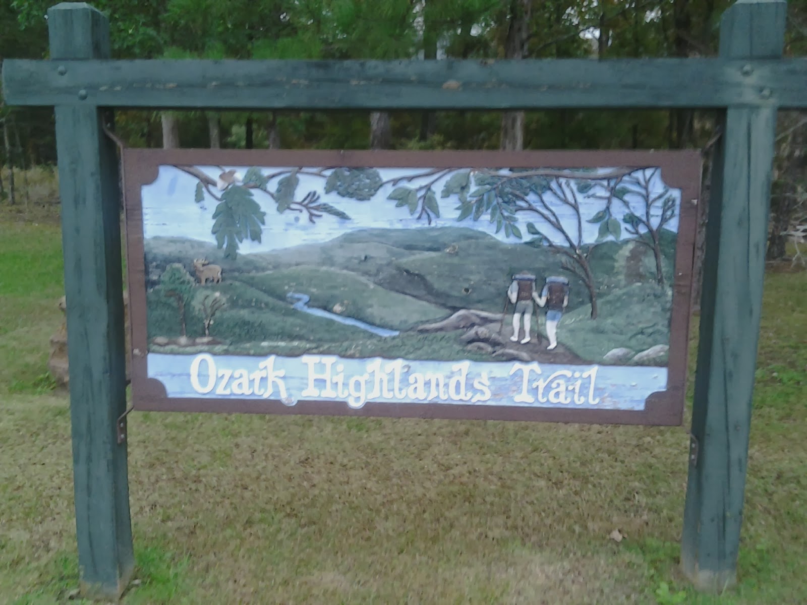
Saturday, November 2, 2013
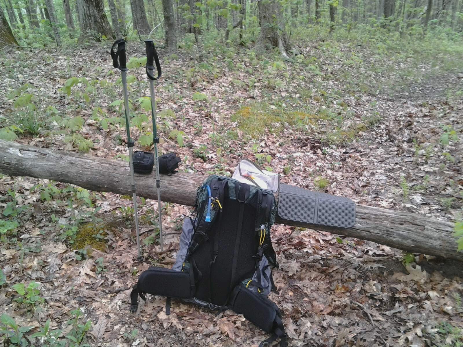
OHT - Day 5 - Mile 71
From the time I crawled in my tent last night until this morning it pretty much rained non stop. To be quite honest the rain was quite soothing. I didn't get much sleep, but I did feel a little more relaxed.
I was able to get cell service last night and found out Hill Hiker would be heading out my way to visit and bring a little trail magic. As meeting up with him was the main reason for heading to AR for some hiking this was good news!
Most of the am was ridge walking and as most of the time it was raining the views were limited. The trail has been somewhat non eventful with no wildlife seen as of yet (1 deer running away from me as I spooked it) and NO vistas at all. The colors have changed dramtically giving the only highlight to what so far has been a wooded tunnel. From the way the guidebook describes the trail you would think it would be in better shape :( There are a lot of old blow downs along the trail and many parts overgrown. Too bad :(
Oh well....off to meet Hill Hiker, have a few beers and share some stories.
Wednesday, October 30, 2013
OHT - Day 4 - Mile 63.ish
Headed out early today (around 7:45 am). Still overcast but no rain.
I made the first 9 mile in about 3.75 hours which surprised me as I was still feeling pretty crappy. I waited at a stream crossing for "ozark" (Doug 2 now has a trail name - I gave him Billy Goat, but he would have none of it :) ). I ate lunch until he arrived and then we headed on together.
We had a hellacious climb (1000') to a ridgeline where we hoped to get cell coverage to make sure Hill Hiker made it home safely. This is the first place that I've got reception.
I now lay in my tent with it raining outside making phone calls to family to let them know all is ok.
Until tomorrow....
OHT - Day 2 - mile 31.6

The trail turned into more of what I am use to and by this I mean elevation gains and declines. Nothing too crazy, but we had a couple 1000' climbs.
Today unfortunately brought some tragedy to our party though. Hillhiker had to get off trail today due to injury :( This has really put a damper on my trip as this was the reason I came out to do the OHT. I will travel along and keep him with us in spirit.
I now lay in my tent. We have a pretty good climb to start off the morning so I better get some rest.
HAPPY TRAILS!
OHT - Day 1 - 16.2 miles
The first 7 miles around the lake were relatively flat, but after that the hiking became a little more familiar to the hiking I am used to. We were forced to press on a little further todays as there were very few places to camp. We are now set up on a closed road that leads to what appears to be any old quarry.
Tomorrow seems to be a little more challenging, but Im sure we will be fine :o)
Happy Trails!!
OHT - Day 3 - Mile 47.5

The first climb was a big one, but we did make it to the top of Hare Mtn. Unfortunately the views were limited by heavy cloud cover, but the fall colors are really starting to heat up compensating for the lack of vistas.
We are at camp now and the flu bug which started yesterday has really kicked in. Hopefully over the next day or so I will be rid of it. It is really sucking the wind from my sails :(
On to tomorrow....
Friday, October 25, 2013

Saturday, October 12, 2013
LightHeart Gear - Rain Jacket Review
Today I received a prototype model of a new rain jacket that will be coming out soon by LightHeart Gear. I'm not quite sure when they will be put in full production and ready for sale, but check out their website and see what other goodies they have until then (www.LightHeartGear.com).
I posted an "Initial Impressions" review (video above) that will give a first look at what I found upon receiving.
The material is extremely lightweight and the construction of outstanding quality. The actual weight of the jacket is only 7.4 oz (for the XL that I received) or 210 grams. Since the material is made of silicon nylon it is a little warm, but the design has included pit zips which allow for increased ventilation.
There are 2 large inside pockets that aren't your typical mesh pockets in most jacket designs. They are actually 2 full sized pockets that are constructed in such a fashion that object will stay in place and not wind up on the trail. The external pockets are well thought out too. They have easy access for your hands, but also dip down slightly so if you are carrying small objects they will not easily fall out.
The hood design is unique to other jackets that I have had in the past. The draw string is situated in a manner that allows the hood to be drawn in around the face and not the bill area. With the cinch clips on the draw string the hood is held securely in place when tightened.
I have a 2 week adventure coming up soon which will put this jacket to the test. Once I return I will provide another product review that is "Field Tested".
Until next time.....
Happy Trails!!!
Rovious
Friday, July 19, 2013
Dealing with Bugs (Mosquitoes) on Trail...
As I'm sure most of you have experienced when hiking in the woods, bugs can be a very challenging nuisance to deal with. They fly in your eyes, nose and ears!!! Bite you leaving welts, itching and in some cases bruises (yes bruises...When I came back from the JMT in California I had smacked my arms so many times from mosquitoes that I had bruises up and down my arms).
How do you deal with these little pests? Good question! I have been trying many different scenarios out over the years and so far this is what I have come up with. This by no means completely solves the problem, but has helped quite a bit considering. If you have any suggestions please leave them in the comments section below of this blog or the video so others can learn from your experiences. I will post a follow up to this after my trip and let everyone know how I fared.
Happy Trails.....
Rovious
Sunday, July 7, 2013
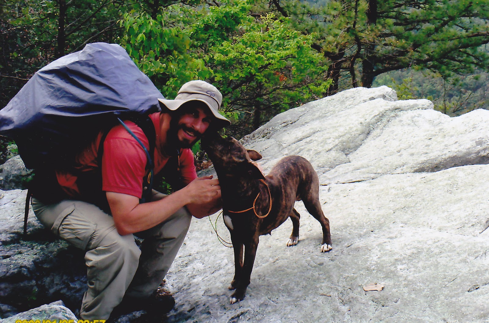
Wonderland Trail Introduction and Initial Planning....
With only a couple weeks left until my father and I embark on an incredible journey together I thought it would be an appropriate time to get things up on this blog for others to follow and hopefully gain a little information and inspiration in the process.
Up to this point we have accomplished just about everything that we need to do in order to hike the trail. Permits/reservations for back country camping and hiking have been secured. All gear has been purchased, finalized and tested for my fathers setup. We have collected and packaged all food items with drop buckets packed and shipped. Airfare has been purchased and rental car has been reserved. The only thing that we really need to do is get out there and start hiking.
I think I covered a lot of the important information in the video above regarding initial planning for this trip. The websites that I found most helpful were: www.WonderlandTrailGuide.com and www.nps.gov. Although there is no real printed guidebook that I could find (that I actually would like to have used that is) the web resources and map should be sufficient to make this trip happen.
If you have come about this blog as a result of researching for a Wonderland Trail hike please feel free to contact me and I will do whatever I can to answer any questions that you may have.
Happy Trails!!!! (stay tuned)
Rovious
Sunday, June 30, 2013
Homemade Beef Jerky...
With my trip quickly approaching I decided it was time to get things in order to ship our drop boxes (actually buckets). With the high price and lower quality associated with buying jerky in the store I decided to break out an old recipe that I have previously used and make my own.
Hopefully this video will help anyone who would like to do this on their own as well.
Happy Trails!!!
Rovious
Friday, April 12, 2013
The Wonderland Trail - Mt. Rainier, WA
 | |
| The Wonderland Trail Around Mt. Rainier in Washington State |
I just received my reservation confirmation for my hike with my father on the Wonderland Trail around Mt. Rainier in Washington. I can't begin to state how excited I am about this trip. We got the itinerary that we wanted and it was only moved one day out from the original start date that we requested.
This trail is supposed to be one of the more beautiful longer distant hikes in the US. From the pictures I have seen and the reports from friends who have already done the trail I don't think it will disappoint.
I know I am leaving this post short and without much information, but I just was too excited not to put it down!!! Stay tuned at the end of summer for a trip report and video.
Happy Trails!!!
Rovious

Saturday, April 6, 2013
Appalachian Trail 2013 - Nantahala Outdoor Center (NOC) to Fontana Dam
This past weekend I was fortunate enough to escape for the weekend and do a small section of the Appalachian Trail from the Nantahala Outdoor Center (NOC) to the Fontana Dam. Although the weather looked ominous per the weather forcast the rain held off and the weekend turned out to be pretty decent for hiking.
We started the trip by making our way to the Fontana Lodge located in Fontana village on Friday evening. I have never stayed in the hotel before, but I can't begin to state how pleasantly surprised I was by the luxury of the accommodations. The warm fire burning in the spacious lobby was so welcoming I felt like I had just been transported to an episode of the "Lifestyles of the Rich and Famous". After watching the season finally of Bering Sea Gold it was off to bed to catch a few zzz's before catching our shuttle back to the NOC in the morning.
Saturday, March 2, 2013
Appalachian Trail 2013 - Glassmine Gap to the NOC
Two weeks ago I had the fortunate pleasure of joining an adventure back to the Appalachian Trail. A friend of a friend is working on section hiking the AT and had planned a hike from Glassmine Gap to the Nantahala Outdoor Center (NOC). The 36 mile stretch (including the Long Branch Trail - approx. 2 miles to get onto the AT) was to be completed in 3 days with mileages of 12, 18 and 6 MPD.
We headed to Wesser, NC on Thursday night to stay at the NOC's bunk house. Our bunkhouse had 2 sets of bunk beds, a bench and a cozy heater which seemed to keep the place a little warmer than I had expected. Arriving around 9 pm we were eager to get out of the car and the cold and get a good nights sleep before heading out the next morning.
Our shuttle driver arrived on schedule at 8am Friday without a hitch. Unfortunately this time of year the NOC is a little short staffed and do not provide shuttles, but they did provide a couple alternate options for other providers. I contacted "To The Top and Beyond" Shuttle Service and was very pleased with Kathy's punctuality.
It seemed to take quite a bit of time to get to the trail head. The back roads were winding and slow, but it did provide some very good scenery. At one point we followed a very large river that looked quite breathtaking with the low laying fog that had settled on its surface.
We were on the trail by around 10:30.
I will let the video speak for the rest of the journey, but I would like to make one special point to thank Apple who provided some excellent "Trail Magic" when it was needed most. After hiking in the snow all morning and afternoon and knowing I would be sitting in a cold shelter waiting for my hiking partners to arrive, finding a nice warm place to rest and fuel up couldn't have been better. This gentleman donates 2 weeks of his time every year to providing assistance, food and kindness to travelers on the AT looking to fulfill their lifelong dreams. Just goes to show that there still are some people out there who are genuinely good people who do for others without expecting anything in return. Thank you again Apple!!!! You made our day!!!
 | |
| "Apple" from Cincinnati, OH |
Happy Trails!!
Rovious

Thursday, February 7, 2013
Skiing-WinterPlace Ski Resort, West Virginia

WinterPlace Ski Resort is located just off exit 28 on Route 77 in West Virginia. It is only about 5 minutes from the interstate and easily accessible by many East coast cities. They have about 20 ski runs ranging in varying difficulties. The runs are a little short and narrow, but for the price and proximity it was well worth it.

The weather turned out to be perfect conditions for a day on the slopes. The temperature when we arrived was a balmy 16 degrees and sunny. After a good long weight in line to purchase lift tickets and get our ski rentals the clouds moved in and the snow started. I heard varying reports throughout the day on how much snow had accumulated, but the general consensus was between 6-8".
 | ||
| On one of the ski lifts. |
Until next time....Happy Trails!!
Rovious
Friday, January 11, 2013
Get Out and Hike 2013!!!
 |
| Duncannon, PA. A friend who helped and inspired me to "Get Out and Hike" |
As I sit here on the brink of another hiking season I have been getting quite a few questions regarding an assortment of topics in regards to hiking and backpacking. This year I plan on being more diligent with posting entries and putting together videos to answer questions as well as share what little wisdom and experiences I have acquired that will help others enjoy the great outdoors.
With this being said.....I would like anyone who comes across this little island of mine to leave a comment as to any questions you may have so I can direct my attention and efforts towards what people really want to hear about rather than me just speculating. If you feel more comfortable shooting an email you can do so to GetOutandHike@carolina.rr.com. My goals are simple....I want to motivate as many people as I can to get out into nature as I possibly can!!!
When I started into backpacking I combed the internet for as much information as I could searching videos, blogs and anything to do with hiking. I found a lot of people who helped me out and were willing to share their knowledge and experience. I want to return the favor by passing this information along, share my experiences and help others as I have been helped.
I really appreciate all the kind words people have been sharing with me. It really means a lot and I hope that any information I can share helps!!
Happy Trails!!!
Rovious
Tuesday, January 8, 2013
Appalachian Trail - Halfway Point from last season
This is a video I shot from last years AT thru hike attempt as I reached the halfway marker.
I looked back on this video and saw something in myself that made me realize who I am and what makes me tick. So many people in life will try to discourage you from being who you are. Not because they are being selfish or because they want to keep you from being what you want to be, but simply because they don't understand. Simplicity and a break from what the world today suggests is the norm may not make sense to most, but this doesn't mean you can't stray from that. Don't let people take your dreams away!! They are yours!!! The only thing between them is your willingness to not let others keep them from you!!! Live life my friends for it is the only one you have!!!
Happy Trails!!!
Rovious
Monday, January 7, 2013
Appalachian Trail - Cell Phones Revisited

On the cusp of a new Appalachian Trail Thru Hiking Season I find myself receiving a lot of questions regarding the use of cell phones on the trail. I put up a post before my thru hike attempt last season and decided to update my findings from the experiences I had.
It seemed that a number of carriers provide pretty decent service along the trail with my experience being one of the exceptions. I chose to go with a "Pay as you Go" phone from Verizon. This unfortunately was a very big mistake!!! Initially I went to a local Verizon dealer and grilled them on the coverage that the phone would provide being very detailed and explicit to my usage along the trail and where I would be needing coverage. I know I must have annoyed the salesman because I asked the same question multiple times: "Would I have the same coverage as all Verizon customers along the duration of the Appalachian Trail?". The response was YES!! on all occurrences. At the time the store did not have any of the prepaid phones in stock so I was directed to Best Buy where they had plenty available. Again I asked multiple times if the phone would suit my needs and provide the coverage that I needed (I am a little OCD and anal when it comes to subjects like this :) ). I once again received the same response....Yes sir, you will get the same coverage as all Verizon Customers!!!
The truth of the matter is that you do not get the same coverage as all Verizon customers. For the most part I got very poor coverage along the trail with the Pay-As-You-Go phones. While I was surrounded by multiple people who had a regular contract with Verizon and multiple "Bars" talking to there friends and family I would be sitting with nothing more than a paper weight. When I reached Hot Springs, NC I used a hiking friends Sprint phone to contact Verizon (because I didn't have service). I was unfortunately the victim of either poor dealer training or just a bad situation all around. They notified me that I was not on the same Tower system as all Verizon customers and that there was no way they would be willing to make the situation right leaving me extremely discouraged.
OK....now that I've gotten my rant out of the way and before I droan on about my bad experience let's get down to the nitty gritty. Verizon (full service customers) and Sprint customers have good reception in most areas of the trail as I can attest to. You may have to stand on one leg, hold your hands in a certain ritualistic position while balancing on your head, but you will get a bar or two even in some remote locations. This is not to say there are some dead spots no matter what carrier you have, but it is amazing how far technology has come and that you can communicate with loved ones from so many locations along the trail. I had also heard about other carriers providing decent service, but I can't personally attest to them as I did not utilize them.
In short I would have to say that Verizon (FULL CUSTOMER CONTRACTS) would be the way to go if you are looking for reliable coverage along the Appalachian Trail. Sprint also provided very good coverage as my hiking buddy Hill Hiker used his very reliably through his entire adventure to Katahdin.
To all 2013 Appalachian Trail Thru Hikers.....I wish you the best, Happy Trails and enjoy the memories, friends and the Journey!!!!! Maybe I'll run into a few of you during my trips to the mountains this year!!
Happy Trails!!!
Rovious
Monday, December 24, 2012
Wishing you a Happy Holidays!!!
 |
| Happy Santa!! |
Happy Trails!!!
Rovious
Sunday, December 23, 2012
Winter Solstice Challenge 2012...
Trip Dates: December 14-16, 2012
Trip Location: Kings Mountain State Park, SC
Trails: Blue Blaze Hiking Trail (makes a loop around Kings Mtn) & Ridgeline Trail
This year I took it upon myself to resurrect a trip that one of my hiking friends always organized in the past. Unfortunately for us (but don't feel sorry for her, she is living in Montana now :) ) she has moved on to new adventures leaving it up to someone else to take the reigns. For my first attempt we had a pretty good turnout. Thanks to Becky, Gina, Kenny and Chris for coming out!!
The Winter Solstice Challenge is just a good excuse to get out in winter and enjoy the outdoors. The underlying idea is to hike from Crowder's Mountain State Park in North Carolina to Kings Mountain State Park in SC and back in one day. The total mileage amounts to approx 24 miles round trip. Although I have perfect intentions of making it every time I go out the truth is that I usually have too much fun the night before and wind up waking up too late with a wee bit of a headache to think about pounding out that type of mileage. This year was no different.
The trip took a slight deviation from the original plans due to campground closings at Crowder's Mountain for maintenance. Instead we booked our campsites at the Rustic Campsite Area at Kings Mountain and to be honest it actually worked out better. At Crowder's Mtn you have to hike in about 3/4 of a mile to the campsites we usually stay at where at Kings Mtn there is a nice campground with parking near the sites. They even have hook up accessible sites that you can park your car at. This allowed for more comfort items to be brought as well as grills for eating massive quantities of unhealthy food.
Once again another great weekend of fun, friends and hiking!!!
Happy Trails!!!
Rovious
Monday, October 29, 2012
Shenandoah River Canoe Trip
Trip Info:
Dates - October 27-28, 2012
Location - Shenandoah National Park (Shenandoah River)
Outfitter used - www.DownRiver.com
Mileage - Day 1=10 miles, Day 2=11 miles
This past weekend I headed North to the Shenandoah National Park for a canoe trip with a good friend of mine. As always the trip was a blast and I had to opportunity to see things that I normally wouldn't being cooped up at home.
Although the drive was a bit long it was actually very therapeutic. The fall colors were still hanging on to the trees so the scenery was beautiful. Once out of the city and traveling up route 81 I reached the mountains and rolling hills of Virginia giving me a taste of what we would be spending the next couple days surrounded by.
During the trip we were treated to quite an array of wildlife. Although most of what we saw were different species of birds the ones we did see were anything typical. On the menu were various ducks, water fowl, Blue Herons and a Bald Eagle. Unfortunately I was unable to get my camera out and fired up until it had climbed into the sky, but as it took flight from the river there was no mistaking the 6 foot wingspan and white tail and head. I felt honored to get a glimpse of something so majestic and rare in this part of the country.
I couldn't resist setting the music in the above video to what you will hear if you watch it. :) I hope you enjoy!!
Happy Trails!!
Rovious
Thursday, October 25, 2012
Return to the Appalachian Trail - Hughes Gap to 19E (Roan Mtn, TN)
This past weekend I took my first trip back on the AT. There were a number of emotions that ran through my head as I set foot back on a trail that I spent so much time on and had such a great time experiencing. I would be lying if I said that I didn't want to be back out there for the long haul heading to Kahtadin, but my short time spent hiking was a beautiful experience.
Once again I started one of my favorite sections in the Southeast from Mountain Harbor B&B and Hostel. The proprietors are wonderful people and offer accommodations, food and shuttles to various places locally. I actually was fortunate enough to run into a wave of Southbound AT hikers while there and reminisced about the experiences we had while out hiking.
I was dropped off at Hughes Gap which is at the base of Roan Mountain. From here you will have a pretty good climb ascending about 2200 feet over 2.5 miles. It's a pretty good climb, but you will be rewarded with a spectacular view from the old site of the Cloudland Hotel on a clear day. I typically spend about an hour at this location to relax, eat a meal and enjoy the views. I find myself wondering what it would have been like to spend a weekend at this location/hotel during its hay day.
From here I climbed down Roan Mtn to Carvers Gap passing Roan High Knob Shelter. The shelter is the highest on the AT and notoriously the coldest. I have stayed here once in the past and noticed that it was infested with spiders. It is a double decker shelter that once was used as a fire watchtower station (the tower has been removed, but you can still see the foundation blocks).
Carvers Gap is a good starting point for hiking with ample parking, restrooms and a water source. You will get a nice view of the balds that you are about to traverse from this location and on a clear day you will get 360 degree views from both Round Bald and Jane Bald.
After a good day of hiking and fortunate weather I made my way to OverMountain Shelter. It is an old barn that can house a small army. I usually set my tent up in the clear just outside the shelter so I can get a good view of the sunrise when I wake up. As usual I was not disappointed.
Coming out of the shelter you will have a little bit of a climb. Although a tough way to start the morning the view back at the Shelter is amazing. It really looks like something out of a magazine. With the views of the valley in addition the climb will not seem quite as bad.
Your hard work will not go in vain as you approach Little Hump and Hump Mountains. Once again both are balds that offer 360 degree views on clear days with a good look at Grandfather Mountain in the distance.
Once traversing the summit of Hump Mountain it will be all downhill. I will warn you that the trail gets rocky at times and somewhat slick in icy weather so plan accordingly.
Although the video I put together shows some of the highlights of this trip it is hard to get a true sense for the scenery and magic of nature this hike provides. The best advice I can give is to Get Out and Hike this section of Trail for yourself!!! I assure that you will not be disappointed.
Happy Trails!!!!
Rovious
Monday, October 15, 2012
Thank you and Congratulations Hill Hiker - Class of 2012 Appalachian Trail Thru Hiker

I first met this gentleman hiking slowly up one of the many mountains in the Smokey's just past NewFound Gap. I remember the day I first caught him on the trail, said a friendly hello to one another and then I speed off up the trail. That evening after setting up my tent at the shelter, doing my chores and finally sitting down to eat Hill Hiker crept into camp and sat down next to me for his dinner. Little did I know this little chat would be just the beginning of our several hundred mile trek together.
Recently I received a package from Hill Hiker with several pictures a short letter and a little rubber duck that I remember seeing at one of the hotels we stayed at in Roanoke, VA.
The Letter reads:
"Rovious,
My name is S.H.. An old man named HillHiker rescued me in Roanoke,VA. He carried me in his backpack with a pig named Arkie and we became good friends. HillHiker took Arkie and me out of his pack and took pictures of us from time to time. We finished our trip in Maine atop Mt. Katahdin. HillHiker said I should come live with you and I will have a good chance of hiking in your pack! And HillHiker said you could change my name if you want to....HillHiker said you were a good guy, good friend and that I would enjoy living with you."
This was by far one of the most thoughtful gifts I have ever received!!! The man carried me in spirit the rest of the way after we had to split up!!! I wish I could have been on top of that mountain celebrating with him.
Here are few of the pics he sent along with the duck:


Until our next adventure......
Subscribe to:
Posts (Atom)