Friday, November 7, 2014
Appalachian Trail - Newport, VA (VA42) to Pearisburg, VA (US460) - Trip Report
This past weekend I decided to take a trip down the AT as the fall colors were at their peak. It seemed like the perfect opportunity to get away for a weekend, doing something I truly enjoy, allowing me to clear my mind and get away from it all.
I left Thursday afternoon from work with the intent of arriving before dark at a Hostel I had found in AWOL's AT Guide in Pearisburg, VA. Although the hostel was not close to the trail I didn't mind as I had arranged a shuttle to meet me there, direct me to a parking area (where I would hike back to at the conclusion of my trek), and take me to the trail head in Newport where I would start my adventure. From what the shuttle driver had told me during our phone conversations while arranging the shuttle the hostel would be closed, but I would be able to camp outside without any issue.
When I did arrive at the Holy Family Hostel I was greeted by the owner's daughter and boyfriend (strange situation as I was getting changed in the back of my van in the parking lot). The informed me that the hostel was unlocked and I was welcome to stay inside if I wanted. I did venture in to the hostel and explored what it had to offer. As I did so Gypsy (the boyfriend) came out to speak with me for a bit. We spoke about how he ended up at the hostel on a work for stay and how his section hike from PA southbound had come to an unexpected end when he meet his new girlfriend. We shared stories of our hiking adventures and what it was like to be so attached to the AT. Before he left me for the night he informed me of numerous LARGE blacksnakes that had made the hostel their home. He even pointed out some snake skins that were in the cracks of the walls. He left shortly after and I decided to look through the hostel registry which confirmed such sightings. I quickly decided that my original plan of camping on the lawn next to the cemetary was the better option.
After a good nights rest (not sleep) I awoke early to pack things up and get ready for my driver to arrive. I tore down my tent, loaded my pack and used the hostel to do my morning chores before making my way to the parking area to wait for my shuttle driver.
Don arrived right on time as scheduled and I followed him to the parking area where I would drop off my car. Once there I switched my gear to his vehicle and we were off. He gave me the low down on trail conditions that were definitely beneficial such as water sources (more importantly where they were lacking) and a reroute that had been made since I came through a few years back. He was a real nice guy who is more than willing to help out hikers in need "any time and any place" as he mentioned several times.
We arrived at the trail head in Newport on VA42 just before 8:00 am. I was greeted by a friendly donkey who came rushing to the fence as we pulled off the side of the road. I picked a few of the burrs off its face, patted it on the head and let it lick my hand while Don and I spoke of his encounters with the lovely critter when he dropped other hikers off here. Don wished me luck and we were both on our separate ways - me on a 40 mile trek southbound and he off to a good and hearty breakfast.
After performing the final arrangements to my gear in the dewy high grass of meadow I headed down the trail. The sun was just coming up over the ridge and the sky was filled with hues of pink, orange and blues. I knew right off that this was going to be a great weekend!
The first couple miles of hiking were a gradual uphill. I passed through meadows and farmland before making my way into the woods. I occasionally stopped to take in the scenery, remove layers as I heated up and to just take in what nature had to offer. It had been too long since my last outing and I just got lost my surroundings. The final push to the top was a little steep, but I was rewarded by some amazing views at Kelly Knob.
So many times when I am out hiking I tend to pass the little side trails that lead to picture spots or scenic overlooks. When I am out and about with others we seem to try and get to where we are going and hike at different speeds to get there. Today being alone I was free to hike at my own pace and had no real plan as to where I would stay for the evening. This afforded me the opportunity to stop and take as much time as I wanted for breaks. I decided to take the side trail to Kelly Knob and rest for a bit which I was so glad that I did.
The overlook is an outcropping of rock with deep fissures plunging into the hillside below. I had to jump across a few of them to get to my resting spot, but the views were more than worth the risk. I sat there for about 30 minutes eating a pouch of tuna and a small snack back of chocolate trail mix enjoying the panoramic view. The colors were in full transition with some of the trees already shedding their leaves. It was so quiet with the absence of human activity obvious and welcomed. I finally had to pull myself away as I did need to put at least a few miles on the odometer for the day.
The descent down into the valley was not too strenuous allowing more of an opportunity to keep my eyes on my surrounding and not down on the ground watching for roots, rocks and ruts. At the bottom of the hill was a well flowing stream where I decided to camel up on water and fill up my water bladder for the next 2000' climb that I was about to tackle.
I had opted to take my Sawyer Squeeze on this trip rather than the Sawyer Mini or any of the other pump filters that I have accumulated over the years. I found an adapter trick online that uses a "Tornado Tube" (a child's experiment/toy that is used between two 2 liter bottles to create a simulated tornado) which can be attached between the filter and Platy bags or bottles. I did have to cut about 1/4" off of one end so it would tightly fit onto the filter before leaving, but I am glad I decided to try this out. The flow rate was by far superior to the Sawyer Mini (with the adapter I had created out of an old hydration bite valve tube) and a lot easier to use. It does weigh about an ounce more, but I found it to be worth it for my particular situation.
Fully hydrated and packed up I started my ascent to the top of the next ridge. The climb wasn't all that bad, but did meander all over the hillside and valley making me think that some drunk trail engineer just couldn't make up their mind as to where to put it. This is where I finally ran into my first set of hikers. A couple of old gents in their 70's with packs that were as old school as they were (external frames packs - which I still have one myself, with all sorts of things strapped to the outside). Just goes to show that one doesn't need all the latest and greatest gear to get out and enjoy the simple things in life. We stood and chatted for a bit on the side of the hill before they continued down the mountain and I continued trudging up hill.
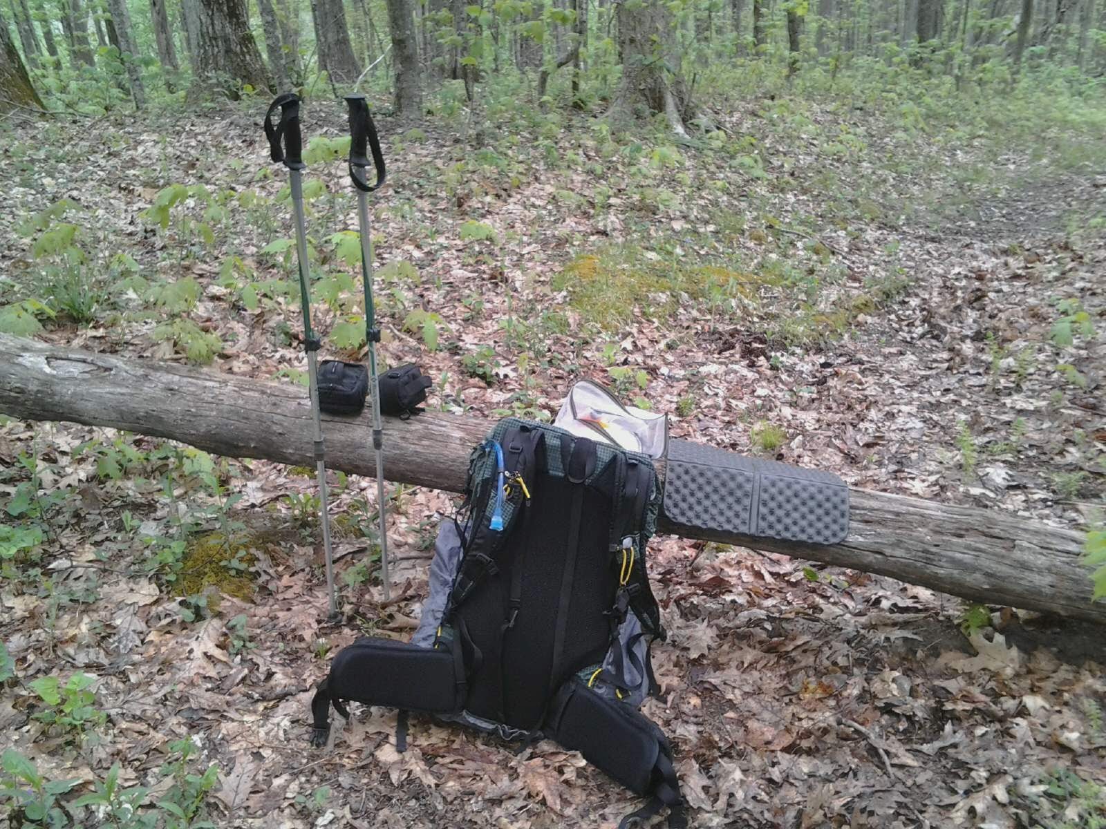
When I finally made it to the top I was more than ready to take a nice long lunch break. As I reached the apex I immediately saw the perfect rock to plop down upon and rest my tired body. Just as I was about to I noticed two oddly placed game cameras on both sides of the trail strapped to the base of trees. For a split second I contemplated moving on and finding another spot to enjoy lunch, but that was only for a second. I decided that whoever had set these up would just have to suffer wading through a few pictures of my enjoying my well earned lunch. I sat down, took out my cook kit to boil some water for my Ramen Noodles, removed my shoes and socks and enjoyed a nice package of beef jerky. It felt so good to sit for a bit and get some calories in my belly. I rested for about 45 minutes before deciding it was time to pack up and head down the trail.
Looking at my map and elevation profile it did not look like the trail would be too difficult as I made my way to Bailey Gap Shelter. I couldn't have been more wrong. The last time I headed through this section of trail I was heading North bound and was on a mission to catch up with my hiking partner who had gotten about a day ahead of me (2012 Thru Hike attempt). That was a 35 mile day and I was in such a zone that I really wasn't paying much attention to the trail at that point. Today was much different as I was not in as good of shape as then and not going nearly as far or fast.
The three miles before the shelter were nothing but rocks covered by a layer of leaves. I couldn't begin to count the numbers of times that I tripped or rolled my ankles while traversing this section of trail. I had let out countless obscenities during and hoped that the soft dirt would return soon. Reading over the ledger at the shelter when I arrived confirmed that I was not the only one who felt this way. The entries from Southbound Thru Hikers who had come by only a day earlier had left comments cursing the rocks in that section as well.
I did arrive at the shelter just before 6pm and decided that this would be the place I stopped for the evening. I sat alone for a while just enjoying the quiet, read the shelter ledger for a while and finally just enjoyed the sun setting over the distant ridge painting the sky with beautiful colors before allowing natures lights to go out in preparation for a starry sky. I climbed into my tent and settled in for a nice long rest.
Unfortunately a deep sleep eluded me over the course of the night. I got plenty of rest and felt extremely relaxed with the sounds of nature surrounding me, but could not get completely comfortable with the pain in my left foot constantly reminding me of the miles of rocks before camp.
I decided to get a good start on the day and crawled out of the warmth and comfort of my sleeping bag before the sun showed its presence. Being a little chilly in the morning usually makes me move a little faster from the point where I unzip my bag to then conclusion of breaking down my tent. It was still dark by the time I was starting my breakfast so I just took my time and waited until it was light enough to start down the trail without killing myself on hidden obstacles.
At 7:30 it was time to get moving. The first few miles were downhill and the soreness in my left foot was pretty noxious. Fortunately the rocks had diminished to normal trail conditions and with a steady supply of Vitamin I the pain became tolerable.
I made it to the bottom of the mountain just as the sun was making it's way over the ridge. The Captain's Place in just off the trail in this area and would make a good resting point for a weary thru hiker, but I had miles to get under my belt and could only stop to take a quick picture and video.
I had stopped at the Pine Swamp Shelter for a quick snack and to fill up my water bags before heading up my one big climb of the day. There is a stretch (heading SOBO) of approximately 11 miles where there isn't any water listed. One could probably hold off for a mile or so past the shelter as a stream follows the trail, but I wasn't taking any chances. I drank 1 liter straight away and filled my Platypus with 2 liters just to make sure. Fueled and hydrated I made my way up the winding path to the top of the ridge.
Once at the top it was pretty much putting it in gear and cruising. The trail was pretty flat (as flat as a mountain could be) and made for a comfortable 2.5 mph pace.
I rested for a bit around noon and ate my lunch on a large fallen tree trunk. As I was packing up two hikers heading my direction strolled upon me. We exchanged hello's and were on our way. The first people I had seen in 24 hours, but I quickly left them behind when they decided to stop for lunch themselves.
Just after passing Symm's Gap the scenery became very appealing. I passed through meadows and pastureland which offered spectacular views of the valley below. With the fall colors painting the mountain sides I couldn't help but to continuously stop and just soak in the views.
I arrived at the Rice Field Shelter a little earlier than expected (3pm). It is a perfect spot to stop with views on both sides of the mountain and plenty of spots to pitch a tent. After mulling it over for a short while I decided to press on the final 6ish miles rather than stay especially since it was still so early in the day, I had not seen anyone else out hiking and the remainder of my hike was all downhill.
The final descent into Pearisburg is a newly opened reroute. I was having a hard time remembering what the trail was coming NOBO when I came through in 2012 as I was trying to put in some big mile days to catch up to the group I had been hiking with, but the grade was definitely a lot more gradual and very wide. The miles seemed to melt by and since the terrain wasn't difficult to navigate I was able to keep my eyes on the surrounding rather than on the ground. I saturated my soul with the fast changing fall colors and smell of fall in the air. I knew it had been too long since I had been out last and this just reaffirmed my need to get out more often.
I made it to my car a little before 6pm and was on my way. A burger was calling my name and it wasn't long before my belly was full and the calories I had burned on this 22+ mile day were replenished.
NOW......onto the next adventure!!!!!!
Happy Trails!!!!
Saturday, June 28, 2014
Appalachian Trail - Hampton, TN to Damascus, VA - Video
Here's the video from my recent adventure....Unfortunately the weather didn't cooperate on the second day so I apologize in advance for the lack of scenery.
Until next time........
Happy Trails!!!!
Rovious
Monday, June 23, 2014
Appalachian Trail - Hampton, TN to Damascus, VA - Day 2 (26.7 miles)

I woke up early this morning to fortunately a lot drier weather than I fell asleep to. I use the birds as an alarm clock as they usually start chirping about 15 minutes or so before the day breaks. Although it was much dryer when I woke up the rains and fog where ever present for most of the day.
I started hiking around 7am and was almost immediately greeted by a feeding deer on the side of the trail. It didn't seem to mind my company much and after checking me out for a minute it continued its grazing. I enjoyed watching it for a few moments and then was on my way.
The day was not very eventful and I spent all morning hiking in a rain cloud where only 20 or so yards in front of me were visible. I was hoping to get some good pictures and videos (especially of the field near the handicap accessible portion of trail), but had to keep the cameras inside my pack to keep from being ruined.
By mile 13 I was feeling pretty tired and had serious doubts that I would make it to my goal of a campsite that was located 4 miles North of Abingdon Shelter. When I finally did arrive at the shelter I immediately took the .2 mile trek down a steep grade to the only water source for several miles. When I got back to the shelter I stripped my soaked shoes and socks off and laid back on my back for about 45 minutes talking myself into getting back up and trudging the final 4 miles.
The 3 Vitamin I (Ibuprofin) that I took at the shelter must have some how energized me. I mistakenly passed the campsite that I was originally going to stay at and found myself at Backbone Rock Trail (5 miles in only 2 hours - I usually only hike around a 2 mph pace). Being only 5:30, having a new found energy and only 4.8 miles into Damascus I decided to push on to Damascus.
I rolled into the middle of town just before 7:30 with visions of hamburgers dancing through my head. If I would have been asked this morning if I could have made it 26+ miles in a day I would have said with 100% certainty "NO". I guess I have to change that to 99% now :)
All in all I had a great time and really enjoyed getting out into the woods for the weekend!!!
Until next time......
Happy Trails!!!!
Rovious
Friday, June 20, 2014
Appalachian Trail - Hampton TN (TN 321) to Damascus VA - 15.7 miles

I hit the trail around 7:50 and easily made my way around Watauga Lake. The trail hits the shore line on several instances so I had really pretty views for the early part of my morning. I stopped and had a snack at the Dam, but had to make it quick as the rain was rolling in.
It only rained for a short time, but I didn't mind as it cooled me down as I made my way up a 2000' ascent. I didn't get much sleep the night before and had a few too many adult beverages at the Pizza Joint in town making for a tiring morning.
I poked along at a slow, but steady pace the rest of the day.
I am now laying in my tent at Iron Mountain Shelter and it has started to rain heavily and thunder. Not sure what I'm in for tonight :O
Saturday, June 14, 2014
Appalachian Trail - Hughes Gap to Erwin, TN - Video
I finally got around to putting together the video from my AT trip in May.
If by chance you come across this post and have any free music that you would be willing to provide to add to my videos I would greatly appreciate it. The selection of Royalty Free music is very limited and as you may have probably noticed not the best suited for what I put together. Thanks in advance for any help!!!!
Until next time.....
Happy Trails and Get Out and Hike!!!
Rovious
Friday, May 16, 2014
Appalachian Trail - Springer Mountain to Neel's Gap - Video
I finally finished the video from our trip to Springer Mountain.
I had to utilize a different video editor this time so I had a bit of a learning curve to deal with.
Happy Trails!!!
Rovious
Sunday, May 11, 2014
Appalachian Trail - Hughes Gap to Erwin, TN - Day 3 (8.8 miles)

It rained for a little while last night, but had tailed off sometime before 12am (the first time I woke up and checked the clock). The rest of the night was a comfortable temperature and very quiet, but for some reason I could not get physically comfortable. I drifted in and out of sleep most of the night and finally decided to get up around 6:10 am.
I hit the trail at a few minutes past 7 and decided I would take a comfortable, but diligent pace back to Uncle Johnny's. The reason for making good time was due to unfortunate circumstances. My hiking partner had hit his limit around Beauty Spot Gap and decided to get off the trail and get a shuttle back to the hostel. Since I had already made camp when I got the news and it was later in the evening I decided to stay out alone and just hike the 8.8 miles to town early the next morning.
I was treated to a beautiful morning full of sunshine, moderate temperatures and beautiful views. A cloud had settled into the lower elevations and since the trees weren't into full bloom I could get a pretty good view of the valley below.
The trip was mostly downhill and I made good time. I still took time to take a lot of pictures and videos as well as take in some of the scenery, but made it back to UJ's by 10:30.
Another great weekend kicking around in the woods!!!
Until the next adventure....
Happy Trails!!!!
Saturday, May 10, 2014
Appalachian Trail - Hughes Gap to Erwin TN - DAY 2 (16 miles)
The day was supposed to be filled with rain, but we were fortunate enough to only get some lite showers for a couple ours around lunch time.
I sat underneath a spruce tree which shaded me from the rain while I ate turkey jerky and granola bars. It wasn't too bad although a bit chilly (my thermometer said 53). I stayed warm by zipping up my rain jacket and huddling next to the tree.
My 2 favorite parts of the day were the spruce forest and the view from Beauty Spot. Both offered their own unique splendor and mysitque.
I rolled into camp at 4:30 and did my chores. The sun is just now trying to make its way through the clouds while I lay here in my tent typing before getting ready to eat dinner.
Until tomorrow....
Friday, May 9, 2014
Appalachian Trail - Hughes Gap to Erwin TN - Day 1 (5 miles)

It was a little strange when I arrived at Hughes Gap at 4:30. I've been to this trail head almost a dozen times, but it's always to head north over Roan Mountain for one of the best sections of the entire AT.
We made our way along a gradual climb over 2.2 miles to the top of Little Rock Knob. Although the sky was overcast and threatening rain we were able to take in a beautiful view of the valley below.
After a snack break we headed down the trail another 2.8 miles to Greesy Creek Gap where I am now typing this listening to the rain spatter on my tent.
Until tomorrow.....
Sunday, April 27, 2014
Springer Fever - Final Day (Day 3)

Last night was just one of those perfect nights for sleeping in a tent in the middle of the woods. The tempature was a little brisk, but not overly cold. The sound of the stream was a soothing lulaby that made for a peaceful sleep.
I didn't start breaking down camp until 6:45, but was packed up with a full belly by 7:30 and heading down the trail.
The climb up to Blood Mountain was a haul. 5 miles of nothing but UP! No worries though...the views offered up by the clear skies were breathtaking and well worth the hard work. I sat at the top for a while eating a snack and taking in the scenery.
The climb down to Neel's Gap was pretty steep and took it's toll on my knees and feet. We arrived at the outfitters around 11:30, took some photos and headed 1/2 down the road to where our car was parked.
Another great trip!!!
Until next time......Happy Trails!!!
Saturday, April 26, 2014
Springer Fever - Day 2

We headed out on the trail by 7:45 and just took my time most of the day. Formula One (AKA Chris) must have ate some Wheeties for breakfast because he spead off and I did see him again until 3:30 at Woody Gap.
Just before lunch I ran into a group of ladies who recognized me from some of my YouTube videos. I thought that was pretty cool and nice to know they might be motivating or inspiring others to Get Out and Hike. So from the trail here's a shout out to you (not sure what their names were-sorry).
The rest of the afternoon was a little warmer than I would have liked (84 degrees), but the skies were clear and a slight breeze picked up around 4ish.
I'm now laying in my tent resting my feet and catching up with my end of day chores. Only 7.2 miles out tomorrow morning, but the climb over Blood Mountain will be a tough one!
Happy Trails!!!
Rovious
Friday, April 25, 2014
Springer Fever has taken over!

Frome the picture above one may guess (correctly) that I am just outside of Springer Mountain. I took this pic around 3 o'clock this afternoon just before heading North on the Appalachian Trail.
I am not heading out to conquer the entire AT, but just enjoying a long weekend in the woods ending up at Neel's Gap.
Todays hike has gone better than expected. We were spared the rain and treated to a day of clear blue skies, breeze and beautiful views still open as the leaves have not fully blocked the way. The body is definetly out of shape, but the sights and peace being out in nature will be more than worth a little soreness.
I've just climbed into my tent and with hopefully drift off to sleep quickly listening to the wind taking in the fresh air.
Until tomorrow.......
Monday, January 20, 2014
Getting Back Into Shape For Upcoming Hiking Season and Health...

The Holidays have been good to me in many ways this past year, but they have also left me with some excess baggage. Eating way too much food and drinking way to many adult beverages have taken their toll and with hiking season quickly approaching it is time to do something about it.
Almost every blog post or gear review video that I see focuses solely on getting the pack weight down to help one overcome those steep inclines, take pressure off sore knees and feet and ease the burden of carrying a heavy load. What about all that extra FAT that we carry around our belly? Sure...hiking will help me lose weight over time, but it will also make my hikes a little more challenging and cause a distraction from what I'm really out there doing - ENJOY MYSELF!!!!
This fitness journey I am about to embark on will not be one of vanity, but one of getting in better health and shedding the extra pounds that I won't have to carry while out on the trail. Now that I am part of the "40+ Club" it is even more important that I take good care of myself and live a cleaner lifestyle (while not sacrificing FUN).
So what does this all mean for someone who might be reading this? A "Yeah Good for you for getting in shape"? My intentions are to allow anyone reading to learn from what I am doing, what I find successful, what I find does not work and hopefully get a little feedback in the process that will help me attain my goals. I will be placing my diet, workout regimen and progress under the "EXERCISE" tab of my blog. I will try and stay diligent with updating it daily and will be completely honest - even when I falter. I will post a weekly Progress report as to my weight loss and fat loss as noted by the scale pictured above. I do not have access to calipers so I will be relying on the "Fat Content" sensor on the scale. I know this is not the most accurate way of measuring, but it's what I have and should do well for my purposes. The real success will be measured by how loose my now tight and difficult to button pants get :).
How am I going to accomplish this goal? Through diet, exercise and cardiovascular training!!!
DIET:
This is a highly personal option and you will have to work the numbers for caloric intake for yourself based on your own personal body. The steps that I took to come up with my diet plan is as follows:
1: Figure out your BMR (Basal Metabolic Rate). There are many calculators out there for you to choose from and they range in complexity.
2: Figure out your lean body mass. The best way to accomplish this is through the use of calipers, but since I don't have access to them I am simply using my weight minus the % body fat that my scale provided. As I said my method is not 100% accurate, but it will suffice for what I am trying to accomplish.
3: Decide what you are trying to accomplish. Are you trying to lose body fat? Do you want to gain muscle? Do you want to maintain your lean body mass and just shed the fat? Once again this is a highly personal decision and this will dictate which direction your diet will take you.
4: Design a diet that will encompass 5-6 small meals a day. They should be low in fat obviously. Count all the calories that you put into your body during the day as they ALL count. That dressing that goes on a salad needs to go in there, the sugar that's put in the coffee.....EVERYTHING!!
EXERCISE:
Decide on a work out program that works for you. Remember...if you don't enjoy doing it the less likely you are to stick with it. I prefer to lift weights for my workouts, but that is not to say aerobic exercise, yoga, circuit training, P90x.....aren't good choices.
CARDIO:
I would recommend doing at least 20-30 minutes a day. This is the key to shedding that nasty fat!!!!! I have never been a big fan of staying on an elliptical or treadmill for extended periods, but it's a MUST to get success. Once again this is a highly personal decision when it comes to what type of cardio you choose, but Get er dun :)
As I said....this is how I am going to go about doing this. This is not the ONLY way, it may not be the correct way, but it's what I will be trying to stick with for a while and see what the outcome is. I have had success with it in the past, but it is hard to stay consistent and true all the time. I am as much a student as a teacher when it comes to this and hopefully by me documenting it here I will be more diligent, help others learn from my mistakes and hopefully learn a bit from others in the process.
I will be posting my diet plan under the "EXERCISE" tab soon. Remember this is what I designed for my body and personal goals. If you choose to follow something similar to this you will need to adapt it to your body.
This mornings weigh in was as follows:
January 20, 2014 - Weight 227# - Body Fat 31% (OUCH - TOO many beers)
Wish me luck!!!! I'm gonna need it!!!!
Happy Trails!!!
Subscribe to:
Posts (Atom)